Mapping Historic Skies with Zooniverse
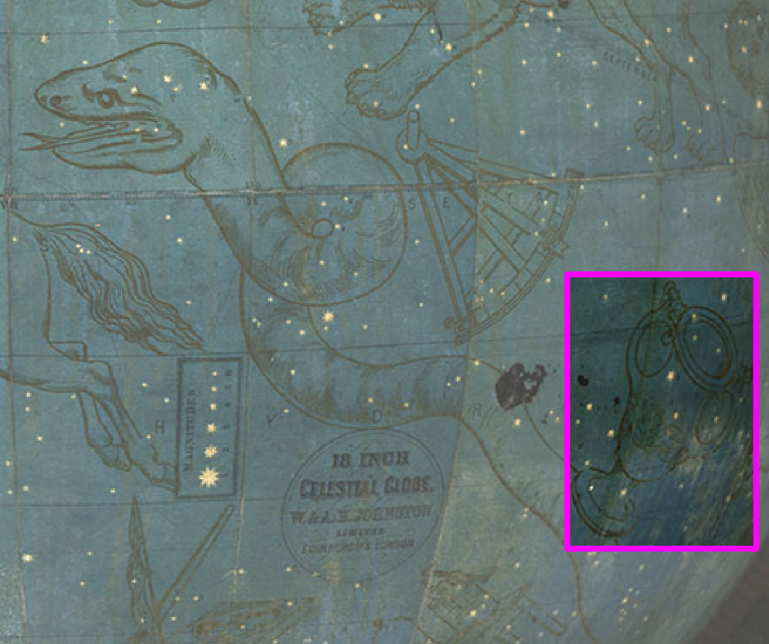
Header Image: Constellation being classified from the Mapping Historic Skies project.
Mapping Historic Skies Team: Jessica BrodeFrank, Pedro Raposo, Sam Blickhan, Becky Rother, and Cliff Johnson.
The Adler Planetarium opened its new exhibit, Chicago’s Night Sky, in November 2019. This exhibit features real science and research from several of the Adler’s program initiatives, including Far Horizons, Youth Organization for Lights Out, and Zooniverse. Mapping Historic Skies is an interactive Zooniverse project experience that connects Adler guests, citizen scientists, and Adler staff. One of the members of the Mapping Historic Skies Team explains how the project works and how you can get involved at home and at the Adler!
The Adler Planetarium’s newest exhibition, Chicago’s Night Sky, contains a first for the museum – an interactive experience that partners the Adler’s historic collection with the Zooniverse team. The exhibit contains two iPads that invite guests to “help us learn about constellations across cultures and centuries” by identifying individual constellations within our historic collection. The Mapping Historic Skies project is the first use of the Zooniverse platform within an Adler exhibition, and the first Adler Collection’s project in Zooniverse!
How It Works
More than 4,000 historical constellation maps and images are included in the application. The Adler’s Collections’ Team is calling on guests to help sort through these images to crop out individual constellations. The goal? To one day to have a database that can show every constellation as it was depicted in different cultures and different times. To do this, first the constellation maps need to be segmented into individual constellations. With 4,000 constellation maps in the collection—and some maps featuring as many as 35 constellations—it is a massive undertaking to crop all these out.
That is where our guests and citizen scientists come in! By placing boxes around each individual constellation they see, guests can help our collections staff sort through these constellations. No expertise or experience is required. You just draw a box around each individual constellation you see. Once 150 people have cropped the same box, the individual constellation is sent to the project on Zooniverse.org where anyone can participate in identifying these individual constellations. The project workflow goes question by question until it successfully ends in a constellation classification.
Impact
The Mapping Historic Skies project is your chance to engage with the Adler’s collections in a curatorial role. You are able to experience firsthand what it means to work with digital collections in a museum setting, and co-create a public database with us! Since launching in November 2019, the project has had over 30,000 classifications made onsite and just shy of 40,000 classifications made online. A perk of joining in on the online identification workflow is that you can join the Talk Boards. The Zooniverse Talk Boards allow participants to converse with each other and with researchers about the data set they are working on. On Mapping Historic Skies we’ve already seen participants adding constellations that were missing from the identification workflow, and helping uncover historic names for current constellations.
Get Involved
You can get involved in this project by participating in the online constellation identification and engaging in the interactive experience in the Chicago’s Night Sky exhibit when the planetarium reopens.